Project Profile
Project Title: „Fechenheimer Mainbogen – Renaturation and Land Consolidation“
Subject Cluster: Climate Protection and Open Spaces
Project Objectives: structural improvement of the Main; creation of a natural landscape with floodplains and habitats for flora and fauna, creation of a nature adventure area with high recreational value, enhanced use of the areas for agriculture.
Planning Area: Frankfurt Fechenheim
Project Start: 2009 - preliminary studies on ecological structural improvement on the Main. November 2013 - planning approval for six individual measures.
January 2015 - Frankfurt City Council approved land consolidation in the Fechenheimer Mainbogen.
Project Duration: until 2020/2022
Project Participants: Environment Office Frankfurt
Multifaceted stretches of water are a valuable asset for plants and animals – and for people. Re-designing the Fechenheimer Mainbogen creates species-rich floodplains and entirely new natural attractions for the residents.
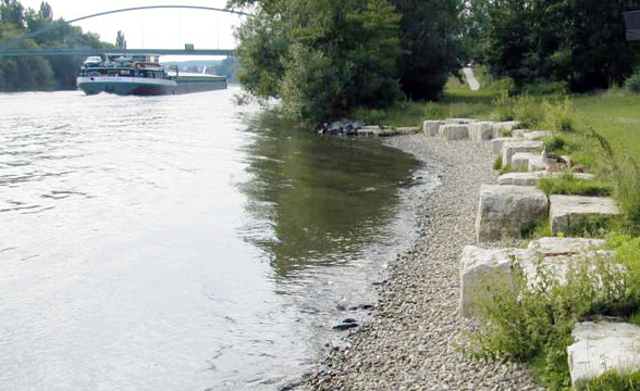
In many places on the Fechenheimer Mainbogen in the East of Frankfurt, the paved banks of the Main will be landscaped more attractively to allow the water to flow through the landscape. On a 90 hectare area, a semi-natural landscape with floodplain character and new, more diverse habitats for flora and fauna will be created. In 2008, Frankfurt commissioned a preliminary study for structural improvements of this kind. The study proposed locations for 39 specific measures along the Main, so the city can realise the goals of the European Water Framework Directive 2000.
Enhanced Riverside and Pond Landscaping
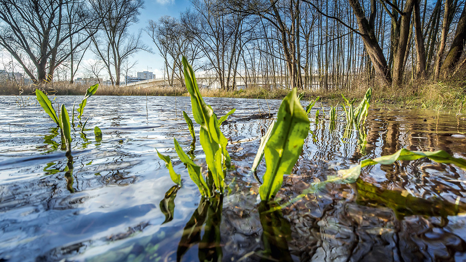
On the Fechenheimer Mainbogen, the first projects were carried out in spring 2015. The bank was levelled off in seven places and the boulders on the bank reinforcement removed. Five smaller temporary stretches of water and three larger oxbow ponds were made. The ponds were excavated close to the shore and modelled with varying slope angles. The ponds, with a total surface area of about 5,000 m², are deep enough to benefit from a constant supply of groundwater.
Cultivating biodiversity through new habitats
To a great extent the riverbank and the water bed will be left to themselves and greened by Nature. In some places the populations of protected species, such as the yellow meadow-rue, will be resettled.
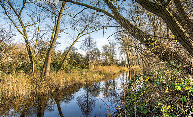
The quiet oxbow ponds with their re-styled banks provide many species with a habitat. In the event of flooding there is an exchange of water with the Main. Fish, like the crucian carp, Common Rudd and trench, are given a place to spawn and grow. Amphibians, like the green frog and grass frog, can spawn in the shallow areas and dragon fly species, such as the Brown Hawker or the Common Darter, can settle there.
Creating floodplains
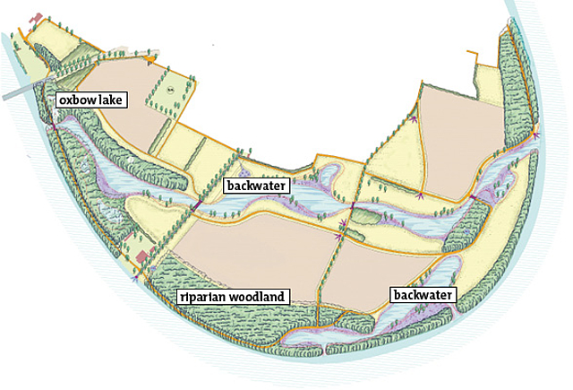
Planning permission has been given for another 3,000 m² oxbow lake and a backwater close to the bank. Unlike oxbow lakes which are separated from the river, a backwater is still connected to the river which feeds it. The planned backwater has a surface area of about 22,000 m² and is connected to the Main in two places, so river water flows constantly through it. The breakthrough created an island which can only be reached by boat.
Still in planning is a 17 km backwater, re-connected to the Main at both ends, which traverses the Mainbogen along a natural hollow and which will be bordered by meadows and riparian woodland.
Re-structuring agriculture areas
As the properties in this area are divided into small lots partly in municipal or in private ownership, re-parcelling is needed before the big backwater can be built. The aim is not only to allocate the areas as municipal property but the property reorganisation also creates coherent farmland and meadows in the higher areas which are then more protected against flooding and can be used better agriculturally.
Experiencing Nature hands-on
Redesigning will partly relocate the present, unattractive riverside path and turn it into a system of pathways with bridges, jetties and panoramic views. This not only creates undisturbed riverbank areas on the Main, but also places with impressive views over the new landscape - a nice place for a stroll.

Landscape
Attractively-designed riverside with meanders and ponds; new, more diverse habitats for fauna and flora, ensuing from close-to-nature landscape with floodplain character.

Experiencing Nature
More attractive landscape; impressive views through newly-designed network with paths, bridges, jetties and observation platforms.

Agriculture
Re-parcelling creates coherent farmland and meadows in the higher areas; agricultural land is more protected against flooding and more usable.
Environment Department
Rainer Zimmermann
Tel +49 (0)69 212-39149
rainer.zimmermann(at)stadt-frankfurt.de


