Project Profile
Project Title: „Europa District “
Subject Cluster: Planning and Construction
Project Objectives: Re-purposing the unused railway land of the former freight station und its shunting yards to an attractive, mixed-use urban district, expansion of the Frankfurt exhibition centre, planning of generous green spaces and urban networking of adjacent urban districts
Planning Area: west of Frankfurt’s city centre, between Bockenheim and Gallus
Project Start: 1998
Project Completion: 2021/22
Project Participants: City Planning Department and other specialised departments
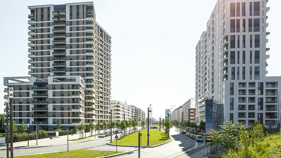
The Europa District has been growing on the site of Frankfurt’s former freight station for 15 years and is one of the biggest inner-city conversion projects in Germany. Re-purposing the unused railway land has created an attractive mixed-use city district with commercial areas, a park and housing for about 15,000 people.
Decommissioning the freight station and its shunting fields gave Frankfurt a great opportunity to convert about 100 hectares of inner-city railway facilities into a new city district. The separating effect of the railway lines was removed and the neighbouring suburbs linked more closely. It was also a unique opportunity for the immediately-adjacent Frankfurt Trade Fair to extend its inner-city location. The Europa District lies to the west of the city centre between Messe, Gallus and Rebstock.
Creating the planning framework
The freight station ceased operations in 1998 and in 2000 Frankfurt City Council agreed on a masterplan for the area. This stipulated that the former railway land was to be allotted in equal shares as residential areas, green spaces, trade fair extension and mixed-use areas. This formed the basis for further planning, such as building and development plans, which was continually updated over the following years.
The freight station (to the East of the Emser Bridge) was quickly decommissioned and in May 2001, the land-use plan for the eastern part of the Europa District was already legally binding. The new Trade Fair Hall 3 and the hotel were the first high-rise buildings but in the meantime building has been completed in large parts of the area.
The shunting yards (west of the Emser Bridge) remained in operation even after the freight station closed and were used as a transit route until mid-2005. This called for phased development of the western Europa District. The corresponding development plans came into force at the start of 2008 and in the middle of 2010.
Building a diversified city district
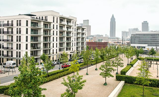
The backbone of the planning is the 60 meter wide, greened Europa Allee which starts at Güterplatz in the east of the Europa District and structures the western planning area. The avenue is framed by a seven-storey enclosed block perimeter development. The northern sector also connects the urban space and the extension areas for the Trade Fair with its large exhibition halls.
In the northwest section there will be two generously laid out purely residential areas, one of which, the „Helenenhöfe”, is to a great extent subsidised housing. In all, a quota of 30 percent subsidised apartments is envisaged in the Europa District. Mixed-use districts with offices, apartments, gastronomy and social facilities are planned for the central sector
In contrast to the initial planning, the number of apartments rose from 3,500 to about 6,000, partly because apartments, not offices, were built on some properties such as Güterplatz. 160 meters high, the „Grand Tower“ will be Germany’s highest residential building with 401 owner-occupied apartments on the 47 storeys. Similar buildings of this type, albeit not so high, are also going up on Boulevard West and beside the Emser Bridge. A new primary school and day nurseries are foreseen at five locations in the new district while supermarkets, shops, gastronomy and medical practices will ensure local amenities.
New green connections emerge
In the middle of the western sector, the Europa Allee will disappear for 400 meters into a tunnel. By 2017, the 6 hectare “Europagarten” above will have been completed and the „Urban Garden of the Future“ will be a place to meet and communicate and an attraction for the Europa District and neighbouring districts. In Spring 2013, with the completion of the small Gleisfeld Park and the three-sided Zeppelin Park, a green link was created to Rebstock Park and the recreational area on the Nidda. The Lotte-Specht-Park has been a green link to the Gallus district in the South since 2014.
A biotope moves away
There was a rich diversity of species in the ballast bed of the tracks. The Wall Lizard, the rare Silver Grass, the Blue Winged Grasshopper and other protected species, which are critically endangered in Hessen , were given 7.4 hectares of new natural habitats at the former approaches to the freight station in the western part of the district.
Award for sustainability
In 2012, the Europa District was one of the first five urban districts in Europe to be awarded the Sustainability Certificate in Platinum of the German Sustainable Building Council (DGNB) which thus recognised its ecological, economic, socio-cultural, functional and technical quality.

Conversion
Conversion of the former freight station and its shunting yards for commercial premises, parks and about 6,000 apartments near the city centre; expansion of the Trade Fair at its inner-city location.

Urban Districts
Residential areas and mixed districts flanking spacious boulevards; 30 percent subsidised housing; amenities such as supermarkets, shops, gastronomy and medical practices, primary school and day nurseries.

Connections
Removing separating effects of the railway tracks and re-connecting suburbs; site development through public transport, new subway line; green link to the Nidda through Europapark and other new parks.
City Planning Department Frankfurt am Main
Ulrich Kriwall
Tel +49 (0)69 212-33253
ulrich.kriwall(at)stadt-frankfurt.de


