Project Profile
Project Title: „Lyoner District – Transformation of a mono-functional office area“
Subject Cluster: Planning and Construction
Project Objectives: Transforming mono-structural Bürostadt Niederrad into a mixed-use suburb (Lyoner District). Reducing the number of empty office buildings, creating new housing.
Planning Area: South of the Main, between Niederrad und Schwanheim, GPS Coordinates: 50.080663, 8.628457
Project Start: 2007
Project Management: City Planning Department Frankfurt
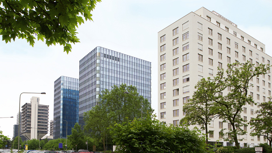
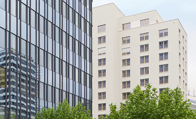
Creating apartments for Frankfurt’s growing population without encroaching on open spaces: room for new housing has been created in Bürostadt Niederrad by converting office space and through infill. At the same time, the number of empty office buildings has dropped and a more vibrant city district has come into being.
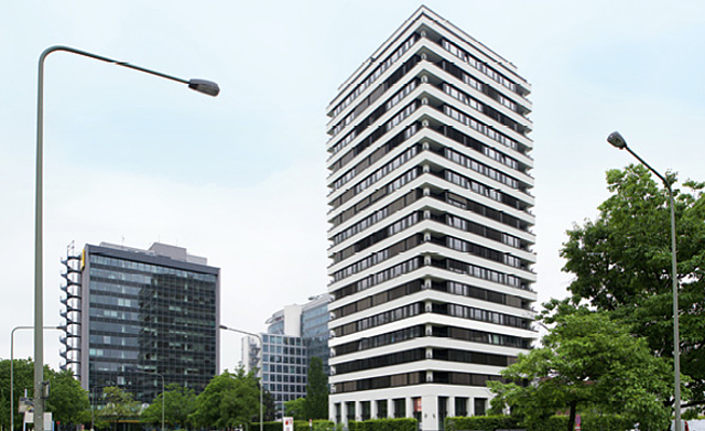
In the 1960s, Bürostadt Niederrad, in the southwest of Frankfurt, was conceived as a purely office district “surrounded by green“. The area, which today consists of office buildings built over the last 50 years and standing on large open spaces, lies between the city centre and the airport and has an underground station, a tramline and easy access to the Autobahn A5.
In 2007, there was an above-average vacancy rate of 30 percent, partly due to inadequate architectural and technical facilities in the older offices and also to infrastructural deficiencies, such as the lack of shopping facilities, gastronomy or also child day care and, of course, due to the competition from newer locations, like Gateway Gardens or the Europa District.
At the same time, Frankfurt registered a rapid increase in its population and in the number of families searching for housing; in other words office premises versus a growing demand for apartments.
Creating mixed use and a good infrastructure
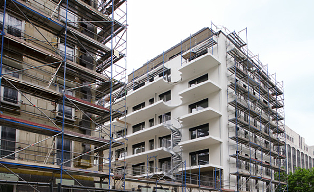
The „Lyoner District “ pilot scheme began in 2007 and will create about 3,000 apartments for 6,000 inhabitants in Bürostadt Niederrad. The office district is to be converted into a bustling mixed-use district by converting empty office blocks, demolishing and re-building unsuitable structures and infilling the generous intermediate areas.
New shops will improve local amenities and create a social infrastructure with child day care, while new streets will improve the internal development of the district and give better access to neighbouring city districts. Public spaces will be upgraded with playgrounds, small parks, grass strips and cycle paths and a new green corridor will connect the River Main and the Stadtwald. The attractiveness of the district will help market the remaining office space and lower the vacancy rate.
Creating planning parameters and offering consultation
Frankfurt has commissioned a number of feasibility and case studies since 2006 as part of the federal research programme „ Experimental Housing and Urban Development (ExWoSt)“. In 2010, work began on planning the parameters for the transformation. The land-use plan for the eastern sector has now come into force and the development plan for the western part will follow suit in the near future. The Planning Office offers owners and investors active advice in the implementation. The public and owners were involved in the planning at an early stage through information events and a questionnaire.
The project gains momentum
The conversion process has been gathering momentum. In the first project in 2010, the office block in Lyoner Straße 19 was converted into 98 apartments. The „Green Six“ project in Hahnstraße 72 with 196 apartments is also finished. In 2016, the municipal housing agency ABG FRANKFURT HOLDING completed 134 rented flats in Lyoner Straße and another 102 rented and 63 freehold apartments and local amenities in Hahnstraße, following the demolition of two office buildings.
By summer 2015, well over 3,000 apartments had been completed, were under construction or in the planning phase. The originally-projected figures had been reached and could still be exceeded as land was still available and demand continued. Besides apartments, office projects are also at the planning stage. The planned development to a mixed-use area is on the road to success.

Living space
Creating additional living space by converting or demolishing buildings and new construction; infill on intermediate areas: preventing uncontrolled urban sprawl on the outskirts of the city.

Upgrading
Creating a more vibrant district with attractive infrastructure (shops, gastronomy, day-care centres); shaping outdoor areas; improving accessibility; making the location more attractive also for offices; lower vacancy rate.

Planning
Creating planning parameters; feasibility and case studies and scientific evaluation; involving owners and the general public; changing development plans; consultation offers for property owners.
City Planning Department Frankfurt am Main
Timo Brühmann
Tel +49 (0)69 212-46905
timo.bruehmann(at)stadt-frankfurt.de


